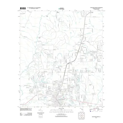
2012 Map of Crestview North
USGS Topo · Published 2012About this map
Tucker Bluff and the winding course of the Yellow River define the northern reaches of this Okaloosa County landscape in the early 21st century. The area exhibits a transition from the riparian terrain of Hudson Island and numerous spring-fed tributaries like Tidwell Mill Cr and Bethel Spring Br to the intensifying development around the northern outskirts of Crestview. Local landmarks such as the Hayward Hayes Overpass and Bob Sikes Airport reflect the modern infrastructure that connects the settlements of Garden City, Auburn, and Silver Springs.
Find a feature on this map
270 named features on this map. Tap any name to fly to it.
Don’t see what you’re looking for? This feature index may not catch every label — zoom into the map to look around manually.
Map Details
Editions of this 2012 Crestview North Map
This is the sole edition of this map. No revisions or reprints were ever made.
Other maps of this area

1934 · Holt
USGS Topo · 1:48,000

1934 · Niceville
USGS Topo · 1:48,000

1936 · Niceville
USGS Topo · 1:62,500

1937 · Holt
USGS Topo · 1:62,500

1949 · Crestview
USGS Topo · 1:62,500

1949 · Laurel Hill
USGS Topo · 1:62,500

1950 · Laurel Hill
USGS Topo · 1:62,500

1951 · Crestview
USGS Topo · 1:62,500

1956 · Niceville
USGS Topo · 1:62,500

1956 · Holt
USGS Topo · 1:62,500