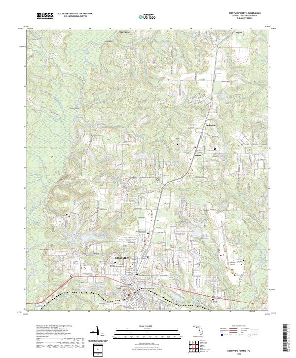
2024 Map of Crestview North
USGS Topo · Published 2024About this map
Crestview serves as the focal point of this North Florida survey, where the Okaloosa County Courthouse and numerous historic burial grounds reflect a well-established community. The landscape is defined by the Yellow River and its myriad tributaries, including Murder Creek and Silver Creek. These waterways, along with features like Sap Ponds and Flowers Pond, suggest a region rich in riparian resources and historical agriculture. The transit network is a mixture of the legacy L & N RR corridor and established rural roads like Old Bethel Rd.
Find a feature on this map
133 named features on this map. Tap any name to fly to it.
Don’t see what you’re looking for? This feature index may not catch every label — zoom into the map to look around manually.
Map Details
Editions of this 2024 Crestview North Map
This is the sole edition of this map. No revisions or reprints were ever made.
Other maps of this area

1934 · Holt
USGS Topo · 1:48,000

1934 · Niceville
USGS Topo · 1:48,000

1936 · Niceville
USGS Topo · 1:62,500

1937 · Holt
USGS Topo · 1:62,500

1949 · Crestview
USGS Topo · 1:62,500

1949 · Laurel Hill
USGS Topo · 1:62,500

1950 · Laurel Hill
USGS Topo · 1:62,500

1951 · Crestview
USGS Topo · 1:62,500

1956 · Niceville
USGS Topo · 1:62,500

1956 · Holt
USGS Topo · 1:62,500