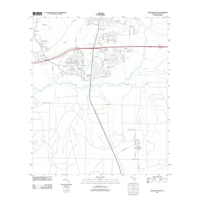
2012 Map of Crestview South
USGS Topo · Published 2012About this map
The Shoal River meanders across this landscape south of Crestview, serving as a primary drainage for numerous smaller waterways such as Gopher Cr and Pearl Cr. This area of Okaloosa County is defined by its significant military presence, notably the sprawling grounds of Aux Field 3 Duke Fld, which includes the Duke Field (Eglin AF Aux Nr 3) Airport. The map documents a blend of established neighborhoods and natural wetlands, with local landmarks like Crain Pond and Lost Boy Pond scattered throughout the drainage basins. Settlement patterns follow the river and key transport routes, with several residential clusters such as those found near John King Rd and King Br. The network of creeks including Turkey Hen Cr and Juniper Cr underscores the complex hydrography of the Florida Panhandle before these waters reach the Gulf.
Find a feature on this map
118 named features on this map. Tap any name to fly to it.
Don’t see what you’re looking for? This feature index may not catch every label — zoom into the map to look around manually.
Map Details
Editions of this 2012 Crestview South Map
This is the sole edition of this map. No revisions or reprints were ever made.
Other maps of this area

1934 · Holt
USGS Topo · 1:48,000

1934 · Niceville
USGS Topo · 1:48,000

1936 · Niceville
USGS Topo · 1:62,500

1937 · Holt
USGS Topo · 1:62,500

1949 · Crestview
USGS Topo · 1:62,500

1949 · Laurel Hill
USGS Topo · 1:62,500

1950 · Laurel Hill
USGS Topo · 1:62,500

1951 · Crestview
USGS Topo · 1:62,500

1956 · Niceville
USGS Topo · 1:62,500

1956 · Holt
USGS Topo · 1:62,500