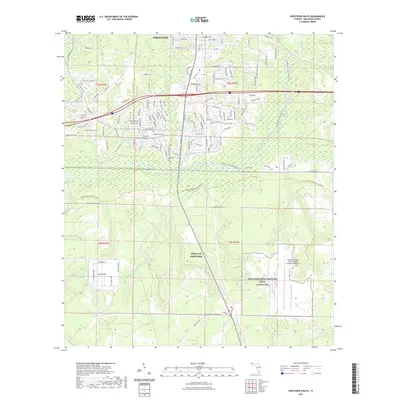
2021 Map of Crestview South
USGS Topo · Published 2021About this map
The Shoal River carves through the heart of this landscape, separating the southern expansion of Crestview from the extensive military lands of Eglin Air Force Base. In the early 21st century, this area represents a significant intersection of recreational corridors and defense infrastructure, featuring the Florida National Scenic Trl and the Shoal River State Paddling Trl winding through the riparian corridor. Further south, the map is dominated by Eglin Air Force Auxiliary Field 3 Duke Fld, also known as Duke Field. Small water bodies like Clyde Reese Pond, Dugan Pond, and Lost Boy Pond dot the terrain, while numerous tributaries including Turkey Hen Cr and Trammel Cr drain the sandy Florida Panhandle soil toward the river basin.
Find a feature on this map
149 named features on this map. Tap any name to fly to it.
Don’t see what you’re looking for? This feature index may not catch every label — zoom into the map to look around manually.
Map Details
Editions of this 2021 Crestview South Map
This is the sole edition of this map. No revisions or reprints were ever made.
Other maps of this area

1934 · Holt
USGS Topo · 1:48,000

1934 · Niceville
USGS Topo · 1:48,000

1936 · Niceville
USGS Topo · 1:62,500

1937 · Holt
USGS Topo · 1:62,500

1949 · Crestview
USGS Topo · 1:62,500

1949 · Laurel Hill
USGS Topo · 1:62,500

1950 · Laurel Hill
USGS Topo · 1:62,500

1951 · Crestview
USGS Topo · 1:62,500

1956 · Niceville
USGS Topo · 1:62,500

1956 · Holt
USGS Topo · 1:62,500