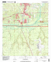
1994 Map of Crestview South
USGS Topo · Published 1999About this map
Crestview expansion and the vast footprint of Eglin Air Force Base define the landscape of south Okaloosa County during the mid-1990s. The northern portion of the sheet shows the southern edges of the city, including the Crestview Country Club and the residential growth near Brook Ave. Industrial activity is evident in the numerous claypits and sandpits dotting the hillsides, particularly near Interchange 12 and the central ridge.
Find a feature on this map
43 named features on this map. Tap any name to fly to it.
Don’t see what you’re looking for? This feature index may not catch every label — zoom into the map to look around manually.
Map Details
Editions of this 1994 Crestview South Map
This is the sole edition of this map. No revisions or reprints were ever made.
Other maps of this area

1934 · Holt
USGS Topo · 1:48,000

1934 · Niceville
USGS Topo · 1:48,000

1936 · Niceville
USGS Topo · 1:62,500

1937 · Holt
USGS Topo · 1:62,500

1949 · Crestview
USGS Topo · 1:62,500

1949 · Laurel Hill
USGS Topo · 1:62,500

1950 · Laurel Hill
USGS Topo · 1:62,500

1951 · Crestview
USGS Topo · 1:62,500

1956 · Niceville
USGS Topo · 1:62,500

1956 · Holt
USGS Topo · 1:62,500