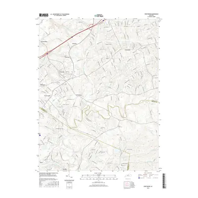
2016 Map of Crestwood
USGS Topo · Published 2016About this map
Floyds Fork and its numerous tributaries, including Ashers Run and Long Run, carve a dense drainage network across this suburbanizing landscape on the edge of the Louisville metro area. The map illustrates the convergence of three counties—Oldham, Jefferson, and Shelby—where established communities like Crestwood and Pewee Valley serve as anchors for a region transitioning from agrarian roots to modern residential enclaves. Local history and genealogy are deeply embedded in the land, evidenced by the clustered Confederate Cem and Pewee Valley Cem, alongside rural burial grounds like Pleasant Hill Cem and Flat Rock Cem. The presence of the Woodledge Farm Airport reflects the mix of private aviation and large-lot residential patterns typical of this era, while the intricate network of named roads like Old Zaring Rd and Elder Park Rd provides a detailed grid for tracing property locations and family homesteads near settlements like Floydsburg and Centerfield.
Find a feature on this map
188 named features on this map. Tap any name to fly to it.
Don’t see what you’re looking for? This feature index may not catch every label — zoom into the map to look around manually.
Map Details
Editions of this 2016 Crestwood Map
This is the sole edition of this map. No revisions or reprints were ever made.
Other maps of this area

1905 · Prospect
USGS Topo · 1:62,500

1907 · Louisville
USGS Topo · 1:62,500

1912 · Prospect
USGS Topo · 1:62,500

1929 · Taylorsville
USGS Topo · 1:62,500

1932 · La Grange
USGS Topo · 1:62,500

1938 · Owen
USGS Topo · 1:24,000

1948 · Owen
USGS Topo · 1:24,000

1951 · Anchorage
USGS Topo · 1:24,000

1951 · Crestwood
USGS Topo · 1:24,000

1951 · Jeffersontown
USGS Topo · 1:24,000