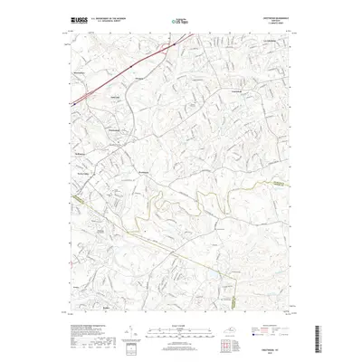
2019 Map of Crestwood
USGS Topo · Published 2019About this map
Pewee Valley and the surrounding suburban landscapes of Jefferson and Oldham counties are documented here in detail, showcasing a region defined by its historic cemeteries and winding creek valleys. The map highlights the Confederate Cem and Pewee Valley Cem, serving as significant markers for local heritage and genealogy. The topography is shaped by the sprawling drainage networks of Floyds Fork and Currys Fork, which carve through the terrain near settlements like Floydsburg and Glenarm. Notable transportation and land-use features include the Woodledge Farm Airport and the complex web of residential corridors such as La Grange Rd. The boundary lines between Oldham Co, Jefferson Co, and Shelby Co intersect in the southern and eastern portions of the map, illustrating the political geography of this growing corridor near Louisville.
Find a feature on this map
196 named features on this map. Tap any name to fly to it.
Don’t see what you’re looking for? This feature index may not catch every label — zoom into the map to look around manually.
Map Details
Editions of this 2019 Crestwood Map
This is the sole edition of this map. No revisions or reprints were ever made.
Other maps of this area

1905 · Prospect
USGS Topo · 1:62,500

1907 · Louisville
USGS Topo · 1:62,500

1912 · Prospect
USGS Topo · 1:62,500

1929 · Taylorsville
USGS Topo · 1:62,500

1932 · La Grange
USGS Topo · 1:62,500

1938 · Owen
USGS Topo · 1:24,000

1948 · Owen
USGS Topo · 1:24,000

1951 · Anchorage
USGS Topo · 1:24,000

1951 · Crestwood
USGS Topo · 1:24,000

1951 · Jeffersontown
USGS Topo · 1:24,000