2023 Map of Creswell
USGS Topo · Published 2023About this map
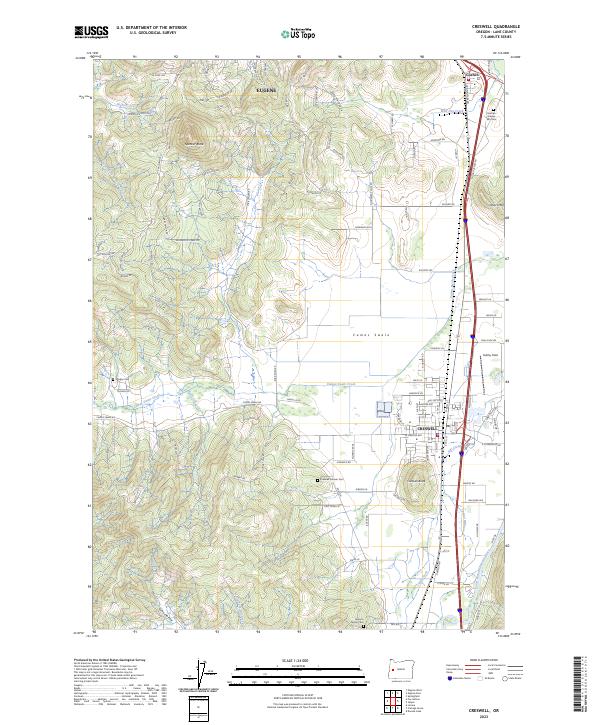
The Coast Fork Willamette River winds through the eastern portion of this Lane County landscape, where the valley floor transitions into the prominent heights of Spencer Butte and the Hideaway Hills. This area is defined by the intersection of rural agriculture and early aviation history at Hobby Field, situated just north of the growing community of Creswell. Local genealogy and family history are deeply rooted here, evidenced by several established burial sites including Creswell Pioneer Cem, the Moxley Cem, and the Jackson Family Cem.
Find a feature on this map
108 named features on this map. Tap any name to fly to it.
Don’t see what you’re looking for? This feature index may not catch every label — zoom into the map to look around manually.
Map Details
Editions of this 2023 Creswell Map
This is the sole edition of this map. No revisions or reprints were ever made.