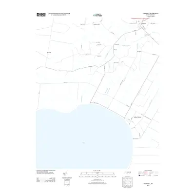
2013 Map of Creswell
USGS Topo · Published 2013About this map
Phelps Lake dominates the southern reaches of this landscape, its expansive shoreline meeting a complex network of man-made waterways designed to manage the low-lying terrain. The town of Creswell serves as the primary hub in the northeast, where W Main St and E Main St anchor the local community near the Scuppernong River. The surrounding area is defined by a dense grid of canals, including the Thirty-Foot Canal, Ninefoot Canal, and Bee-Tree Canal, which illustrate the region's historic reliance on drainage for agriculture and settlement. Smaller communities like Galilee Mission, Mount Tabor, and Cherry are connected by rural routes such as Newland Rd and Cherry Rd. Landmark crossings like Spruills Bridge and Phelps Bridge indicate how residents traversed the many branches and canals, while the area labeled New Lands suggests the continued expansion of usable ground in this distinctive coastal plain environment.
Find a feature on this map
60 named features on this map. Tap any name to fly to it.
Don’t see what you’re looking for? This feature index may not catch every label — zoom into the map to look around manually.
Map Details
Editions of this 2013 Creswell Map
This is the sole edition of this map. No revisions or reprints were ever made.
Other maps of this area

1914 · Belhaven
USGS Topo · 1:48,000

1916 · Belhaven
USGS Topo · 1:62,500

1943 · Columbia
USGS Topo · 1:125,000

1943 · Plymouth
USGS Topo · 1:125,000

1953 · Columbia West
USGS Topo · 1:24,000

1953 · Rocky Mount
USGS Topo · 1:250,000

1954 · Rocky Mount
USGS Topo · 1:250,000

1954 · Roper North
USGS Topo · 1:24,000

1954 · Roper South
USGS Topo · 1:24,000
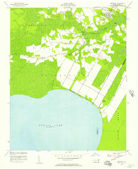
1954 · Creswell
USGS Topo · 1:24,000