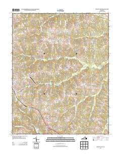
2013 Map of Crewe East
USGS Topo · Published 2013About this map
Nottoway Court House serves as a historic anchor in this section of Virginia, situated near the headwaters of Woody Cr and Watson Cr. The landscape is defined by the dendritic drainage patterns of the Little Nottoway River and its numerous tributaries, such as Deep Cr and Winningham Cr. These waterways historically dictated the placement of early settlements and road networks that remain visible today.
Find a feature on this map
67 named features on this map. Tap any name to fly to it.
Don’t see what you’re looking for? This feature index may not catch every label — zoom into the map to look around manually.
Map Details
Editions of this 2013 Crewe East Map
This is the sole edition of this map. No revisions or reprints were ever made.
Other maps of this area

1891 · Farmville
USGS Topo · 1:125,000

1893 · Farmville
USGS Topo · 1:125,000

1897 · Amelia
USGS Topo · 1:125,000

1943 · Amelia
USGS Topo · 1:31,680

1943 · Richmond
USGS Topo · 1:250,000

1947 · Roanoke
USGS Topo · 1:250,000

1949 · Richmond
USGS Topo · 1:250,000
1950 · Wellville
USGS Topo · 1:24,000

1958 · Jetersville
USGS Topo · 1:62,500

1958 · Crewe
USGS Topo · 1:62,500