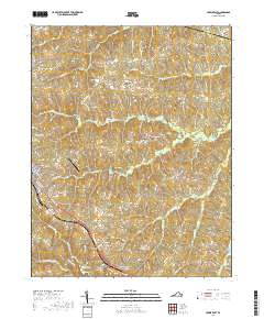
2019 Map of Crewe East
USGS Topo · Published 2019About this map
Crewe and Nottoway Court House anchor this portion of Nottoway County, reflecting the region's long-standing identity as a center of both local government and railroad-era development. The grid of Crewe is sharply defined by its residential streets such as E Virginia Ave and E Colonial Trl, while the administrative heart of the county remains situated at the Nottoway County Courthouse. The surrounding rural landscape is deeply etched by a network of family-named burial grounds and small waterways, including Strum Cem, Towler Cem, and the winding Winningham Cr.
Find a feature on this map
69 named features on this map. Tap any name to fly to it.
Don’t see what you’re looking for? This feature index may not catch every label — zoom into the map to look around manually.
Map Details
Editions of this 2019 Crewe East Map
This is the sole edition of this map. No revisions or reprints were ever made.
Other maps of this area

1891 · Farmville
USGS Topo · 1:125,000

1893 · Farmville
USGS Topo · 1:125,000

1897 · Amelia
USGS Topo · 1:125,000

1943 · Amelia
USGS Topo · 1:31,680

1943 · Richmond
USGS Topo · 1:250,000

1947 · Roanoke
USGS Topo · 1:250,000

1949 · Richmond
USGS Topo · 1:250,000
1950 · Wellville
USGS Topo · 1:24,000

1958 · Jetersville
USGS Topo · 1:62,500

1958 · Crewe
USGS Topo · 1:62,500