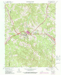
1968 Map of Crewe West
USGS Topo · Published 1987About this map
The junction of the Norfolk And Western and Southern railroads serves as the historical anchor for this region of Nottoway County, centering on the town of Burkeville. The landscape is a network of small rural settlements and institutional landmarks, notably the Piedmont State Hospital and the nearby Filtration Plant. Genealogists can find several country churches and small schools that supported these farming communities, including Wards Chapel, Morning Star Ch, and the Ingleside Sch.
Find a feature on this map
33 named features on this map. Tap any name to fly to it.
Don’t see what you’re looking for? This feature index may not catch every label — zoom into the map to look around manually.
Map Details
Editions of this 1968 Crewe West Map
3 editions found

Other maps of this area

1891 · Farmville
USGS Topo · 1:125,000

1893 · Farmville
USGS Topo · 1:125,000

1947 · Roanoke
USGS Topo · 1:250,000

1958 · Farmville
USGS Topo · 1:62,500

1958 · Jetersville
USGS Topo · 1:62,500

1958 · Crewe
USGS Topo · 1:62,500

1958 · Keysville
USGS Topo · 1:62,500

1959 · Roanoke
USGS Topo · 1:250,000

1963 · Roanoke
USGS Topo · 1:250,000
1968 · Deatonville
USGS Topo · 1:24,000