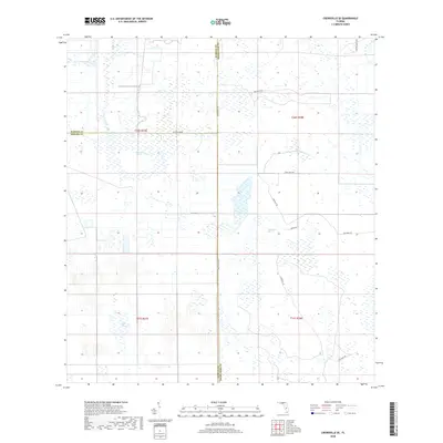
2018 Map of Crewsville SE
USGS Topo · Published 2018About this map
The intersection of Hardee, DeSoto, and Highlands counties reveals a landscape defined by expansive wetlands and a geometric network of remote roads and grades. Central to this interior Florida territory is Negrotown Marsh, a significant hydrological feature that feeds into the broader drainage system of Fisheating Cr. The map illustrates a transitional environment where agricultural infrastructure meets native wetlands, characterized by Oak Creek Marsh and Long Point Marsh. Historical movement through this often-inundated terrain is traced by established routes such as the Footman Trl and the longitudinal Ten Mile Grade, which provide structure to an otherwise fluid geography. Modern ranching and land management are evident through named access points like Skipper Ranch Rd and Ben Hill Griffin road, marking the continued utility of this rural backcountry.
Find a feature on this map
20 named features on this map. Tap any name to fly to it.
Don’t see what you’re looking for? This feature index may not catch every label — zoom into the map to look around manually.
Map Details
Editions of this 2018 Crewsville SE Map
This is the sole edition of this map. No revisions or reprints were ever made.
Other maps of this area

1952 · Sebring
USGS Topo · 1:24,000

1953 · Lake June In Winter
USGS Topo · 1:24,000

1953 · Venus NW
USGS Topo · 1:24,000

1953 · Crewsville SE
USGS Topo · 1:24,000

1953 · Crewsville
USGS Topo · 1:24,000

1956 · Sweetwater
USGS Topo · 1:24,000

1956 · Crewsville SW
USGS Topo · 1:24,000

1956 · Fort Pierce
USGS Topo · 1:250,000

1957 · Long Island Marsh NW
USGS Topo · 1:24,000

1957 · Long Island Marsh NE
USGS Topo · 1:24,000