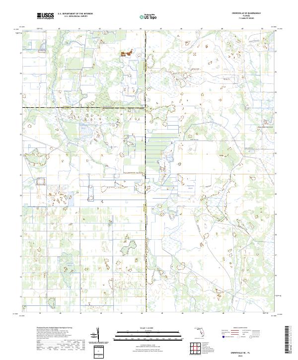
2024 Map of Crewsville SE
USGS Topo · Published 2024About this map
The boundary intersection of Highlands, Hardee, and DeSoto counties characterizes this interior Florida landscape, where water and drainage define the geography. Expansive wetlands such as Negrotown Marsh, Oak Creek Marsh, and Long Point Marsh dominate the terrain, illustrating the intricate hydrology of the region. The flow of Oak Creek and Fisheating Creek move through a mosaic of low-lying lands punctuated by Hog Island Hammock. Human intervention is marked by a grid-like system of rural access points, including the notable Ten Mile Grade and various trails like Footman Trl. This documentation of the area's physical composition reveals a landscape managed for cattle ranching and conservation, where ranch roads like Skipper Ranch Rd provide essential transit across the varied marshland and hammock environments.
Find a feature on this map
21 named features on this map. Tap any name to fly to it.
Don’t see what you’re looking for? This feature index may not catch every label — zoom into the map to look around manually.
Map Details
Editions of this 2024 Crewsville SE Map
This is the sole edition of this map. No revisions or reprints were ever made.
Other maps of this area

1952 · Sebring
USGS Topo · 1:24,000

1953 · Lake June In Winter
USGS Topo · 1:24,000

1953 · Venus NW
USGS Topo · 1:24,000

1953 · Crewsville SE
USGS Topo · 1:24,000

1953 · Crewsville
USGS Topo · 1:24,000

1956 · Sweetwater
USGS Topo · 1:24,000

1956 · Crewsville SW
USGS Topo · 1:24,000

1956 · Fort Pierce
USGS Topo · 1:250,000

1957 · Long Island Marsh NW
USGS Topo · 1:24,000

1957 · Long Island Marsh NE
USGS Topo · 1:24,000