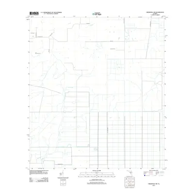
2012 Map of Crewsville SW
USGS Topo · Published 2012About this map
Agricultural and pastoral operations define the landscape of south-central Florida in the early 21st century. Keller Ranch and Crewsville Dairy anchor the northern reaches of the quadrangle, reflecting the region's enduring cattle and dairy heritage. The land is intricately partitioned by a network of rural roads and grades, including Ten Mile Grade and NE 4 Mile Grade, which facilitate movement between scattered homesteads and larger operations like the Fish Branch Tree Farm. Waterways such as Joshua Creek and the small tributary Fish Br wind through the terrain, providing essential drainage for the surrounding fields and pastures. This 2012 survey illustrates a transition toward systematic land management while maintaining its deep-rooted rural character through named family roads like Scarborough Rd and Ed Douglas Rd.
Find a feature on this map
16 named features on this map. Tap any name to fly to it.
Don’t see what you’re looking for? This feature index may not catch every label — zoom into the map to look around manually.
Map Details
Editions of this 2012 Crewsville SW Map
This is the sole edition of this map. No revisions or reprints were ever made.
Other maps of this area

1953 · Crewsville SE
USGS Topo · 1:24,000

1953 · Crewsville
USGS Topo · 1:24,000

1956 · Gardner
USGS Topo · 1:24,000

1956 · Sweetwater
USGS Topo · 1:24,000

1956 · Zolfo Springs
USGS Topo · 1:24,000

1956 · Crewsville SW
USGS Topo · 1:24,000

1956 · Fort Pierce
USGS Topo · 1:250,000

1957 · Long Island Marsh NW
USGS Topo · 1:24,000

1957 · Arcadia
USGS Topo · 1:24,000

1957 · Long Island Marsh NE
USGS Topo · 1:24,000