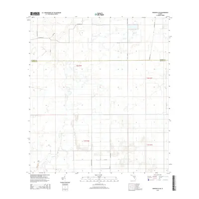
2015 Map of Crewsville SW
USGS Topo · Published 2015About this map
Joshua Cr winds through the south-central portion of this rural Florida landscape, marking the primary drainage for the agricultural and range lands that define the region. The map captures a moment in the mid-2010s where the boundary between Hardee Co and DeSoto Co divides a grid of citrus groves, pasture, and wetlands. Transportation in this interior section of the state is characterized by long, straight utility roads and named routes that reflect local land management, such as Ten Mile Grade and NE Four Mile Grade. Private holdings and rural homesteads are accessed by a network of secondary roads including Fish Branch Rd, Scarborough Rd, and Al Britten. The terrain is generally low-lying, evidenced by the numerous wetlands and small water bodies that punctuate the rectilinear survey sections.
Find a feature on this map
17 named features on this map. Tap any name to fly to it.
Don’t see what you’re looking for? This feature index may not catch every label — zoom into the map to look around manually.
Map Details
Editions of this 2015 Crewsville SW Map
This is the sole edition of this map. No revisions or reprints were ever made.
Other maps of this area

1953 · Crewsville SE
USGS Topo · 1:24,000

1953 · Crewsville
USGS Topo · 1:24,000

1956 · Gardner
USGS Topo · 1:24,000

1956 · Sweetwater
USGS Topo · 1:24,000

1956 · Zolfo Springs
USGS Topo · 1:24,000

1956 · Crewsville SW
USGS Topo · 1:24,000

1956 · Fort Pierce
USGS Topo · 1:250,000

1957 · Long Island Marsh NW
USGS Topo · 1:24,000

1957 · Arcadia
USGS Topo · 1:24,000

1957 · Long Island Marsh NE
USGS Topo · 1:24,000