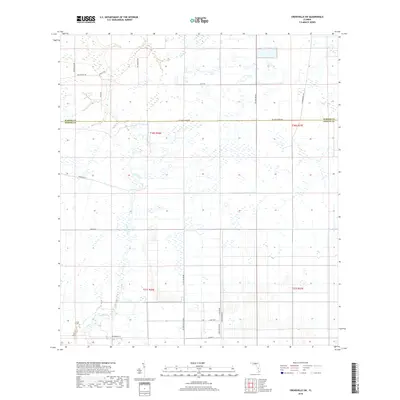
2018 Map of Crewsville SW
USGS Topo · Published 2018About this map
Joshua Cr and its associated wetlands define the southern landscape of this Florida interior region, while Fish Br cuts through the northern sections near the county line. This 2018 survey documents a remote agricultural and citrus-growing area where the rectilinear grid of modern property lines and maintenance roads intersects older named routes. The boundary between Hardee and DeSoto counties is marked along Ten Mile Grade Rd, a significant local corridor that likely historically served as a primary transportation artery through the flatwoods. Named thoroughfares such as Ed Douglas Rd, Scarborough Rd, and Fish Branch Rd provide evidence of family-named landmarks and long-established landholdings. To the south, the presence of Washington St and Al Britten road labels indicates pockets of development and local infrastructure within the vast, water-rich basin of the Peace River watershed.
Find a feature on this map
25 named features on this map. Tap any name to fly to it.
Don’t see what you’re looking for? This feature index may not catch every label — zoom into the map to look around manually.
Map Details
Editions of this 2018 Crewsville SW Map
This is the sole edition of this map. No revisions or reprints were ever made.
Other maps of this area

1953 · Crewsville SE
USGS Topo · 1:24,000

1953 · Crewsville
USGS Topo · 1:24,000

1956 · Gardner
USGS Topo · 1:24,000

1956 · Sweetwater
USGS Topo · 1:24,000

1956 · Zolfo Springs
USGS Topo · 1:24,000

1956 · Crewsville SW
USGS Topo · 1:24,000

1956 · Fort Pierce
USGS Topo · 1:250,000

1957 · Long Island Marsh NW
USGS Topo · 1:24,000

1957 · Arcadia
USGS Topo · 1:24,000

1957 · Long Island Marsh NE
USGS Topo · 1:24,000