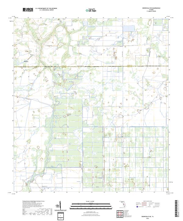
2024 Map of Crewsville SW
USGS Topo · Published 2024About this map
The settlement of Gardner and the meandering path of Joshua Creek anchor this rural landscape along the boundary of Hardee and DeSoto counties. This modern topographic survey highlights a region defined by extensive agricultural grids and a network of named grade roads that reflect the area's land management and drainage history. Features such as Ten Mile Grade and 10 Mile Grade Rd delineate the flat terrain, while smaller connectors like Fish Branch Rd and Doyle Rd provide access to the interior sections. The map reveals the precise township and range divisions, including t36s r26e and t37s r27e, which are essential for property researchers and genealogists tracing land ownership in this part of Florida. The sparse but clear distribution of residential structures along roads like NE Mercer St suggests a low-density rural community characterized by open acreage and seasonal wetlands.
Find a feature on this map
23 named features on this map. Tap any name to fly to it.
Don’t see what you’re looking for? This feature index may not catch every label — zoom into the map to look around manually.
Map Details
Editions of this 2024 Crewsville SW Map
This is the sole edition of this map. No revisions or reprints were ever made.
Other maps of this area

1953 · Crewsville SE
USGS Topo · 1:24,000

1953 · Crewsville
USGS Topo · 1:24,000

1956 · Gardner
USGS Topo · 1:24,000

1956 · Sweetwater
USGS Topo · 1:24,000

1956 · Zolfo Springs
USGS Topo · 1:24,000

1956 · Crewsville SW
USGS Topo · 1:24,000

1956 · Fort Pierce
USGS Topo · 1:250,000

1957 · Long Island Marsh NW
USGS Topo · 1:24,000

1957 · Arcadia
USGS Topo · 1:24,000

1957 · Long Island Marsh NE
USGS Topo · 1:24,000