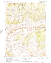
1960 Map of Crimson Dawn
USGS Topo · Published 1985About this map
Casper Mountain dominates this mid-century survey of the high country south of Casper, where the landscape transitions from steep slopes to the broad reaches of Muddy Mountain. The area is characterized by seasonal camps and early recreational development, including the Hogadon Basin Ski Area and Casper Mountain County Park. For the local historian, the map preserves the location of Eadsville, a former settlement site near Asbestos Spr, and several organized camps such as Camp Sacajawea and Casper Lions Camp.
Find a feature on this map
36 named features on this map. Tap any name to fly to it.
Don’t see what you’re looking for? This feature index may not catch every label — zoom into the map to look around manually.
Map Details
Editions of this 1960 Crimson Dawn Map
2 editions found
Other maps of this area

1949 · Brookhurst
USGS Topo · 1:24,000

1950 · Brookhurst
USGS Topo · 1:24,000

1950 · Goose Egg
USGS Topo · 1:24,000

1951 · Casper
USGS Topo · 1:24,000

1955 · Casper
USGS Topo · 1:250,000

1958 · Casper
USGS Topo · 1:250,000

1960 · Twin Buttes
USGS Topo · 1:24,000

1960 · Crimson Dawn
USGS Topo · 1:24,000

1960 · Sheep Creek
USGS Topo · 1:24,000

1960 · Ice Cave Mountain
USGS Topo · 1:24,000