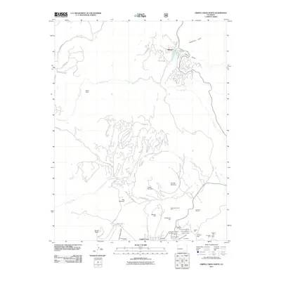
2011 Map of Cripple Creek North
USGS Topo · Published 2011About this map
The gold mining heritage of the Pikes Peak region is on full display in the northern outskirts of Cripple Creek. The landscape is dominated by high-altitude features like Rhyolite Mountain and Mount Pisgah, but the cultural significance lies in the dense cluster of claims and excavations concentrated near Poverty Gulch. The infrastructure of the area’s industrial past is visible through a network of mine sites, including the Mollie Kathleen Mine, Gold King Mine, and Josie B Shaft Mine.
Find a feature on this map
83 named features on this map. Tap any name to fly to it.
Don’t see what you’re looking for? This feature index may not catch every label — zoom into the map to look around manually.
Map Details
Editions of this 2011 Cripple Creek North Map
This is the sole edition of this map. No revisions or reprints were ever made.
Other maps of this area

1894 · Pikes Peak
USGS Topo · 1:125,000

1901 · Pikes Peak
USGS Topo · 1:125,000

1901 · Pikes Peak
USGS Topo · 1:62,500

1942 · Cover Mtn.
USGS Topo · 1:62,500

1948 · Cover Mtn.
USGS Topo · 1:62,500

1951 · Cripple Creek South
USGS Topo · 1:24,000

1951 · Big Bull Mountain
USGS Topo · 1:24,000
1951 · Pikes Peak
USGS Topo · 1:24,000

1951 · Cripple Creek North
USGS Topo · 1:24,000

1954 · Woodland Park
USGS Topo · 1:24,000