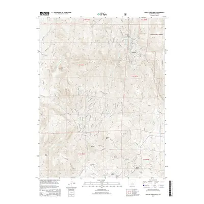
2016 Map of Cripple Creek North
USGS Topo · Published 2016About this map
Cripple Creek sits at the southern edge of this high-altitude landscape, where the northern reaches of the famous mining district meet the foothills of the Pike National Forest. The map detail reveals a complex network of residential and mountain roads, including Teller Co Road 1 and the winding Dome Rock Trl, illustrating the modern layout of these historic gold fields. The topography is defined by a series of prominent peaks and gulches that once fueled the region's economy, from the heights of Mt Pisgah and Rhyolite Mtn to the depths of Poverty Gulch. Near the settlement of Midland, the terrain transitions into steeper drainages like Putney Gulch and Buchannon Gulch. This 2016 survey documents the continued intersection of public lands, residential development, and the legacy of the mineral-rich mountainsides.
Find a feature on this map
115 named features on this map. Tap any name to fly to it.
Don’t see what you’re looking for? This feature index may not catch every label — zoom into the map to look around manually.
Map Details
Editions of this 2016 Cripple Creek North Map
This is the sole edition of this map. No revisions or reprints were ever made.
Other maps of this area

1894 · Pikes Peak
USGS Topo · 1:125,000

1901 · Pikes Peak
USGS Topo · 1:125,000

1901 · Pikes Peak
USGS Topo · 1:62,500

1942 · Cover Mtn.
USGS Topo · 1:62,500

1948 · Cover Mtn.
USGS Topo · 1:62,500

1951 · Cripple Creek South
USGS Topo · 1:24,000

1951 · Big Bull Mountain
USGS Topo · 1:24,000
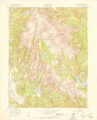
1951 · Pikes Peak
USGS Topo · 1:24,000

1951 · Cripple Creek North
USGS Topo · 1:24,000

1954 · Woodland Park
USGS Topo · 1:24,000