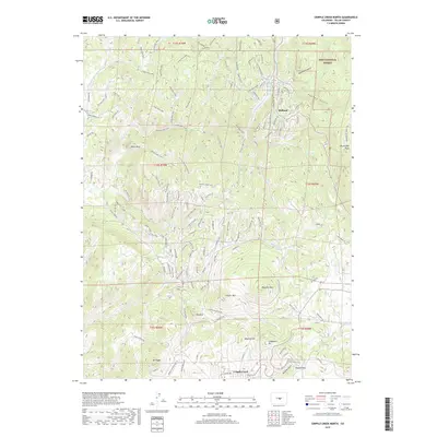
2019 Map of Cripple Creek North
USGS Topo · Published 2019About this map
Cripple Creek sits at the southern edge of this landscape, a place defined by its mining heritage and high-altitude geography. The map reveals a complex network of canyons and peaks, including Mineral Hill and Carbonate Hill, whose names echo the region's historical mineral extraction. To the north, the terrain transitions into the protected lands of the Pike National Forest and the Dome Rock SWA, where Dome Rock serves as a prominent landmark.
Find a feature on this map
130 named features on this map. Tap any name to fly to it.
Don’t see what you’re looking for? This feature index may not catch every label — zoom into the map to look around manually.
Map Details
Editions of this 2019 Cripple Creek North Map
This is the sole edition of this map. No revisions or reprints were ever made.
Other maps of this area

1894 · Pikes Peak
USGS Topo · 1:125,000

1901 · Pikes Peak
USGS Topo · 1:125,000

1901 · Pikes Peak
USGS Topo · 1:62,500

1942 · Cover Mtn.
USGS Topo · 1:62,500

1948 · Cover Mtn.
USGS Topo · 1:62,500

1951 · Cripple Creek South
USGS Topo · 1:24,000

1951 · Big Bull Mountain
USGS Topo · 1:24,000
1951 · Pikes Peak
USGS Topo · 1:24,000

1951 · Cripple Creek North
USGS Topo · 1:24,000

1954 · Woodland Park
USGS Topo · 1:24,000