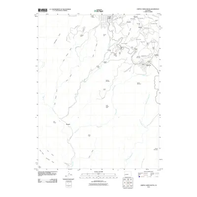
2010 Map of Cripple Creek South
USGS Topo · Published 2010About this map
Cripple Creek and the surrounding high-altitude mining districts are documented here in a landscape defined by nearly a century of industrial activity. The dense concentration of extraction sites in the northern and eastern portions of the sheet, including the Vindicator Mine, Elkton Mine, and Cresson Mine, illustrates the intensity of the region's legendary gold-mining history. Between the organized streets of Victor and the smaller settlements of Hollywood and Goldfield, the terrain is heavily marked by shafts and tunnels, such as the Roosevelt Tunnel, which once supported these deep-earth operations.
Find a feature on this map
77 named features on this map. Tap any name to fly to it.
Don’t see what you’re looking for? This feature index may not catch every label — zoom into the map to look around manually.
Map Details
Editions of this 2010 Cripple Creek South Map
This is the sole edition of this map. No revisions or reprints were ever made.
Other maps of this area

1894 · Pikes Peak
USGS Topo · 1:125,000

1901 · Pikes Peak
USGS Topo · 1:125,000

1901 · Pikes Peak
USGS Topo · 1:62,500

1942 · Cover Mtn.
USGS Topo · 1:62,500

1948 · Cover Mtn.
USGS Topo · 1:62,500

1951 · Cripple Creek South
USGS Topo · 1:24,000

1951 · Big Bull Mountain
USGS Topo · 1:24,000
1951 · Pikes Peak
USGS Topo · 1:24,000

1951 · Cripple Creek North
USGS Topo · 1:24,000

1954 · Phantom Canyon
USGS Topo · 1:24,000