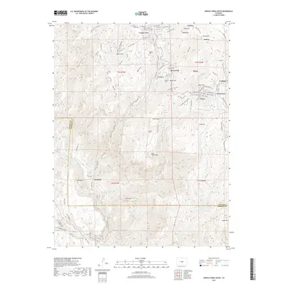
2019 Map of Cripple Creek South
USGS Topo · Published 2019About this map
Cripple Creek and the high-altitude mining landscape of the southern Front Range define this late 2010s survey. The map details a dense network of former mining camps and established mountain towns, including Victor, Goldfield, and Elkton. The industrial history of the district is etched into the terrain through subterranean engineering like the Roosevelt Tunnel and Carlton Tunnel, which drain the complex geology beneath the peaks.
Find a feature on this map
99 named features on this map. Tap any name to fly to it.
Don’t see what you’re looking for? This feature index may not catch every label — zoom into the map to look around manually.
Map Details
Editions of this 2019 Cripple Creek South Map
This is the sole edition of this map. No revisions or reprints were ever made.
Other maps of this area

1894 · Pikes Peak
USGS Topo · 1:125,000

1901 · Pikes Peak
USGS Topo · 1:125,000

1901 · Pikes Peak
USGS Topo · 1:62,500

1942 · Cover Mtn.
USGS Topo · 1:62,500

1948 · Cover Mtn.
USGS Topo · 1:62,500

1951 · Cripple Creek South
USGS Topo · 1:24,000

1951 · Big Bull Mountain
USGS Topo · 1:24,000
1951 · Pikes Peak
USGS Topo · 1:24,000

1951 · Cripple Creek North
USGS Topo · 1:24,000

1954 · Phantom Canyon
USGS Topo · 1:24,000