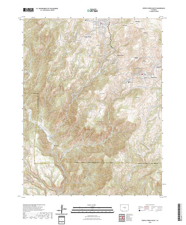
2023 Map of Cripple Creek South
USGS Topo · Published 2023About this map
Cripple Creek and the high-altitude mining districts of Teller County are meticulously documented in this modern survey. The map details the dense urban core of the county seat, including the Teller County Courthouse, alongside the storied neighboring settlements of Victor, Goldfield, and Elkton. The geography is defined by the legacy of the gold rush, with prominent peaks like Battle Mountain and Globe Hill standing above a complex drainage system that includes Poverty Gulch and Arequa Gulch.
Find a feature on this map
90 named features on this map. Tap any name to fly to it.
Don’t see what you’re looking for? This feature index may not catch every label — zoom into the map to look around manually.
Map Details
Editions of this 2023 Cripple Creek South Map
This is the sole edition of this map. No revisions or reprints were ever made.
Other maps of this area

1894 · Pikes Peak
USGS Topo · 1:125,000

1901 · Pikes Peak
USGS Topo · 1:125,000

1901 · Pikes Peak
USGS Topo · 1:62,500

1942 · Cover Mtn.
USGS Topo · 1:62,500

1948 · Cover Mtn.
USGS Topo · 1:62,500

1951 · Cripple Creek South
USGS Topo · 1:24,000

1951 · Big Bull Mountain
USGS Topo · 1:24,000
1951 · Pikes Peak
USGS Topo · 1:24,000

1951 · Cripple Creek North
USGS Topo · 1:24,000

1954 · Phantom Canyon
USGS Topo · 1:24,000