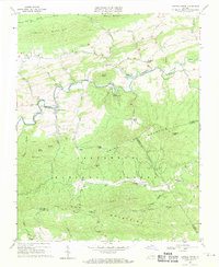
1968 Map of Cripple Creek
USGS Topo · Published 1971About this map
The iron industry and rural settlements of southwest Virginia are well documented in this 1968 field-checked survey. The landscape is defined by the winding course of Cripple Creek as it flows between Henley Mountain and Ewing Mountain. Relics of the region's industrial past are prominent, with several iron furnaces including Eagle Furnace, Raven Cliff Furnace, and Noble Furnace appearing as ruins along the valley floor.
Find a feature on this map
69 named features on this map. Tap any name to fly to it.
Don’t see what you’re looking for? This feature index may not catch every label — zoom into the map to look around manually.
Map Details
Editions of this 1968 Cripple Creek Map
2 editions found
Other maps of this area

1889 · Hillsville
USGS Topo · 1:125,000

1889 · Wytheville
USGS Topo · 1:125,000

1892 · Hillsville
USGS Topo · 1:125,000

1892 · Wytheville
USGS Topo · 1:125,000

1896 · Hillsville
USGS Topo · 1:125,000

1930 · Speedwell
USGS Topo · 1:62,500

1930 · Independence
USGS Topo · 1:48,000

1930 · Max Meadows
USGS Topo · 1:62,500

1931 · Galax
USGS Topo · 1:48,000

1933 · Independence
USGS Topo · 1:62,500