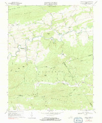
1968 Map of Cripple Creek
USGS Topo · Published 1991About this map
Iron industry remnants define the valley of Cripple Creek in this late-1960s survey of southern Wythe County. The landscape preserves the footprint of a once-thriving charcoal furnace economy, evidenced by the scattered remains of Eagle Furnace, Raven Cliff Furnace, and Noble Furnace. These industrial sites are linked by an Old Railroad Grade that winds through the terrain, tracing the old transport routes that served the various mines and quarries dotting the hillsides at Fry Hill and Hussy Mtn.
Find a feature on this map
67 named features on this map. Tap any name to fly to it.
Don’t see what you’re looking for? This feature index may not catch every label — zoom into the map to look around manually.
Map Details
Editions of this 1968 Cripple Creek Map
2 editions found
Other maps of this area

1889 · Hillsville
USGS Topo · 1:125,000

1889 · Wytheville
USGS Topo · 1:125,000

1892 · Hillsville
USGS Topo · 1:125,000

1892 · Wytheville
USGS Topo · 1:125,000

1896 · Hillsville
USGS Topo · 1:125,000

1930 · Speedwell
USGS Topo · 1:62,500

1930 · Independence
USGS Topo · 1:48,000

1930 · Max Meadows
USGS Topo · 1:62,500

1931 · Galax
USGS Topo · 1:48,000

1933 · Independence
USGS Topo · 1:62,500