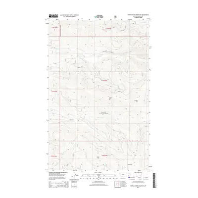
2014 Map of Cripple Horse Mountain
USGS Topo · Published 2014About this map
Kootenai National Forest dominates this topographic survey of Lincoln County, Montana, revealing a landscape defined by sharp elevation changes and high-altitude drainage basins. The area is anchored by Cripple Horse Mtn, with a network of stream systems including S Fork Cripple Horse Cr and N Fork Canyon Cr carving through the terrain. The map documents the infrastructure of the National Forest system, specifically the Natl Forest Develop Road 4898 Rd and Boundary Mtn Rd, which provide access to the high ridges. These forest service routes follow the contours of the land, connecting landmarks such as Hornet Ridge and Snag Gulch. The survey illustrates the complex geography of the American Northwest just after the first decade of the 21st century, showing how the Forest Service manages access to the Boundary Mtn region through a system of designated roads and trails.
Find a feature on this map
21 named features on this map. Tap any name to fly to it.
Don’t see what you’re looking for? This feature index may not catch every label — zoom into the map to look around manually.
Map Details
Editions of this 2014 Cripple Horse Mountain Map
This is the sole edition of this map. No revisions or reprints were ever made.
Other maps of this area

1920 · Jennings
USGS Topo · 1:125,000

1935 · Thompson Lakes
USGS Topo · 1:96,000

1942 · Thompson Lakes
USGS Topo · 1:125,000

1957 · Kalispell
USGS Topo · 1:250,000

1960 · Kalispell
USGS Topo · 1:250,000

1961 · Kalispell
USGS Topo · 1:250,000

1963 · Wolf Prairie
USGS Topo · 1:24,000

1963 · Davis Mountain
USGS Topo · 1:24,000

1963 · Warland Peak
USGS Topo · 1:24,000

1963 · Cripple Horse Mountain
USGS Topo · 1:24,000