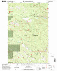
1997 Map of Cripple Horse Mountain
USGS Topo · Published 2000About this map
Kootenai National Forest lands dominate this Lincoln County landscape, defined by high-elevation summits and the deep drainage basins of the Cabinet Mountains region. Steep ridges like Hornet Ridge and peaks including Cripple Horse Mountain and Boundary Mountain rise above a complex network of waterways. The drainage pattern is led by Cripple Horse Creek and its South Fork Cripple Horse Creek, alongside Canyon Creek and its North Fork Canyon Creek. Mapping by the U.S. Geological Survey and the Forest Service reveals a terrain largely devoid of permanent settlements, focused instead on timber and natural resource management, exemplified by a single industrial Gravel Pit in the northwest. This 1990s revision provides a precise record of the road and trail networks used for forest access and fire management in the late twentieth century.
Find a feature on this map
10 named features on this map. Tap any name to fly to it.
Don’t see what you’re looking for? This feature index may not catch every label — zoom into the map to look around manually.
Map Details
Editions of this 1997 Cripple Horse Mountain Map
This is the sole edition of this map. No revisions or reprints were ever made.
Other maps of this area

1920 · Jennings
USGS Topo · 1:125,000

1935 · Thompson Lakes
USGS Topo · 1:96,000

1942 · Thompson Lakes
USGS Topo · 1:125,000

1957 · Kalispell
USGS Topo · 1:250,000

1960 · Kalispell
USGS Topo · 1:250,000

1961 · Kalispell
USGS Topo · 1:250,000

1963 · Wolf Prairie
USGS Topo · 1:24,000

1963 · Davis Mountain
USGS Topo · 1:24,000

1963 · Warland Peak
USGS Topo · 1:24,000

1963 · Cripple Horse Mountain
USGS Topo · 1:24,000