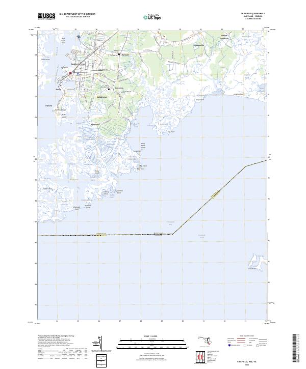
2023 Map of Crisfield
USGS Topo · Published 2023About this map
Crisfield anchors this coastal landscape where the land fragments into the intricate salt marshes of the Chesapeake Bay. The map reveals a dense network of local settlements such as Lawsonia, Sackertown, and Byrdtown, each tied to the tidal rhythms of the Little Annemessex River and Somers Cove. The geography is defined by a maze of tidal guts and points, including Long Point Island and Jersey Island, illustrating the precarious nature of habitation on the Eastern Shore. Local history is grounded in the presence of the Mariners Methodist Cem and Asbury Methodist Cem, which serve as permanent markers for the families of Mariners and Daugherty Town. The boundary between Maryland and Virginia bisects the Pocomoke Sound to the south, highlighting the maritime border that has long shaped the region's fishing and oystering industries.
Find a feature on this map
103 named features on this map. Tap any name to fly to it.
Don’t see what you’re looking for? This feature index may not catch every label — zoom into the map to look around manually.
Map Details
Editions of this 2023 Crisfield Map
This is the sole edition of this map. No revisions or reprints were ever made.
Other maps of this area

1903 · Crisfield
USGS Topo · 1:62,500

1903 · Deal Island
USGS Topo · 1:62,500

1920 · Crisfield
USGS Topo · 1:62,500

1942 · Chesconessex
USGS Topo · 1:31,680

1942 · Terrapin Sand Point
USGS Topo · 1:24,000

1942 · Great Fox Island
USGS Topo · 1:24,000

1942 · Marion
USGS Topo · 1:24,000

1942 · Kingston
USGS Topo · 1:24,000

1942 · Tangier Island
USGS Topo · 1:24,000

1942 · Saxis
USGS Topo · 1:24,000