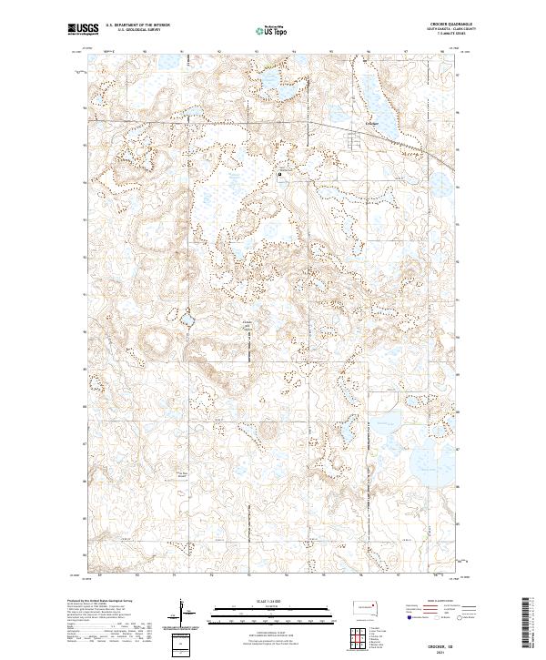
2021 Map of Crocker
USGS Topo · Published 2021About this map
The glacial landscape of the Coteau des Prairies defines this portion of Clark County, characterized by an intricate network of wetlands and small water bodies. The small settlement of Crocker sits in the northern section of the sheet, served by a grid of rural roads including 158th St and Co Rd 55. This environment is shaped by numerous sloughs and basins, most notably Twin Sloughs and the expansive Mallard Slough which dominate the central prairie.
Find a feature on this map
21 named features on this map. Tap any name to fly to it.
Don’t see what you’re looking for? This feature index may not catch every label — zoom into the map to look around manually.
Map Details
Editions of this 2021 Crocker Map
This is the sole edition of this map. No revisions or reprints were ever made.
Other maps of this area

1953 · Milbank
USGS Topo · 1:250,000

1953 · Watertown
USGS Topo · 1:250,000

1958 · Milbank
USGS Topo · 1:250,000

1958 · Watertown
USGS Topo · 1:250,000
1958 · Crandall
USGS Topo · 1:24,000
1973 · Crocker SW
USGS Topo · 1:24,000

1973 · Lily
USGS Topo · 1:24,000

1973 · Bradley
USGS Topo · 1:24,000

1973 · Lone Tree Lake
USGS Topo · 1:24,000
1973 · Crocker
USGS Topo · 1:24,000