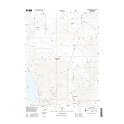
2015 Map of Crocker Mountain
USGS Topo · Published 2015About this map
Plumas National Forest encompasses the high-elevation terrain of this region, where the Sierra Nevada's complex drainage systems form distinct alpine basins. The landscape is defined by its wide valleys, including Thompson Valley, McReynolds Valley, and the expansive Red Clover Valley. These meadows and flats are separated by prominent ridges such as Turner Ridge and peaks like Crocker Mountain. Water is central to the area's geography, with Red Clover Creek and Dixie Cr meandering through the flats before entering tighter canyons. The southwestern portion of the map is dominated by the northern reaches of Lake Davis, specifically around Dan Blough Cove. This 2015 update shows the modern road network, including the Beckworth Genesee Rd, providing access for land management and recreation throughout the high country.
Find a feature on this map
37 named features on this map. Tap any name to fly to it.
Don’t see what you’re looking for? This feature index may not catch every label — zoom into the map to look around manually.
Map Details
Editions of this 2015 Crocker Mountain Map
This is the sole edition of this map. No revisions or reprints were ever made.
Other maps of this area

1886 · Honey Lake
USGS Topo · 1:250,000

1890 · Sierraville
USGS Topo · 1:125,000

1891 · Downieville
USGS Topo · 1:125,000

1891 · Honey Lake
USGS Topo · 1:250,000

1892 · Sierraville
USGS Topo · 1:125,000

1893 · Honey Lake
USGS Topo · 1:250,000

1893 · Downieville
USGS Topo · 1:125,000

1894 · Sierraville
USGS Topo · 1:125,000

1895 · Downieville
USGS Topo · 1:125,000

1896 · Downieville
USGS Topo · 1:125,000