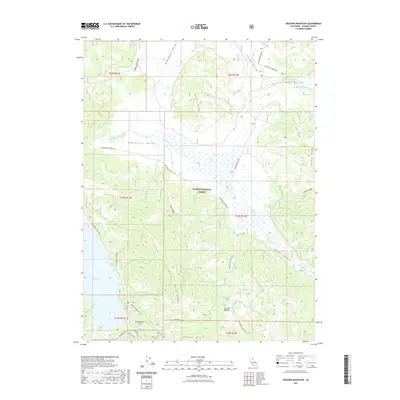
2021 Map of Crocker Mountain
USGS Topo · Published 2021About this map
Crocker Mtn and the surrounding high valleys of the Plumas National Forest define this 2021 landscape. The map centers on the expansive Red Clover Valley, where Red Clover Cr and Dixie Cr converge amidst a network of forest service and county roads like Beckworth Genesee Rd. The southern portion of the sheet is dominated by the northern reaches of Lake Davis and the Grizzly Valley, providing a look at the modern shoreline and recreational access points such as Grasshopper Flat.
Find a feature on this map
38 named features on this map. Tap any name to fly to it.
Don’t see what you’re looking for? This feature index may not catch every label — zoom into the map to look around manually.
Map Details
Editions of this 2021 Crocker Mountain Map
This is the sole edition of this map. No revisions or reprints were ever made.
Other maps of this area

1886 · Honey Lake
USGS Topo · 1:250,000

1890 · Sierraville
USGS Topo · 1:125,000

1891 · Downieville
USGS Topo · 1:125,000

1891 · Honey Lake
USGS Topo · 1:250,000

1892 · Sierraville
USGS Topo · 1:125,000

1893 · Honey Lake
USGS Topo · 1:250,000

1893 · Downieville
USGS Topo · 1:125,000

1894 · Sierraville
USGS Topo · 1:125,000

1895 · Downieville
USGS Topo · 1:125,000

1896 · Downieville
USGS Topo · 1:125,000