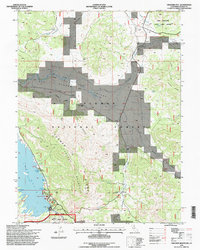
1994 Map of Crocker Mountain
USGS Topo · Published 1998About this map
Lake Davis and the high ridges of the Plumas National Forest define this terrain during the mid-1990s. The landscape is marked by the seasonal recreation and infrastructure surrounding the Grizzly Valley Dam, including boat launches at Honker Cove and camping areas near Grasshopper Flat. An Old Railroad Grade winds through the northern portion of the quadrangle, tracing the historical timber or transit routes that preceded modern forestry management.
Find a feature on this map
40 named features on this map. Tap any name to fly to it.
Don’t see what you’re looking for? This feature index may not catch every label — zoom into the map to look around manually.
Map Details
Editions of this 1994 Crocker Mountain Map
This is the sole edition of this map. No revisions or reprints were ever made.
Other maps of this area

1886 · Honey Lake
USGS Topo · 1:250,000

1890 · Sierraville
USGS Topo · 1:125,000

1891 · Downieville
USGS Topo · 1:125,000

1891 · Honey Lake
USGS Topo · 1:250,000

1892 · Sierraville
USGS Topo · 1:125,000

1893 · Honey Lake
USGS Topo · 1:250,000

1893 · Downieville
USGS Topo · 1:125,000

1894 · Sierraville
USGS Topo · 1:125,000

1895 · Downieville
USGS Topo · 1:125,000

1896 · Downieville
USGS Topo · 1:125,000