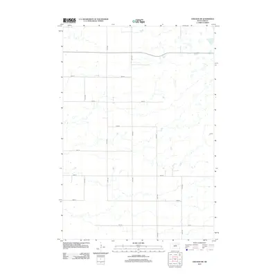
2012 Map of Crocker SW
USGS Topo · Published 2012About this map
Glacial depressions and intermittent wetlands define the topography of this Spink County landscape during the early 21st century. The map shows a strictly organized section-line road system, where corridors like 414th Ave and 413th Ave intersect with east-west routes such as 158th St and 164th St. This grid pattern reflects the enduring legacy of the Public Land Survey System, which dictated the settlement and agricultural development of the eastern Dakotas. The terrain is characterized by numerous small potholes and basins, typical of the drift prairie, which dictate the winding paths of smaller local tracks where they deviate from the rigid section lines. Aside from a few isolated structures, the area remains dedicated to open-field agriculture and water management.
Find a feature on this map
12 named features on this map. Tap any name to fly to it.
Don’t see what you’re looking for? This feature index may not catch every label — zoom into the map to look around manually.
Map Details
Editions of this 2012 Crocker SW Map
This is the sole edition of this map. No revisions or reprints were ever made.
Other maps of this area

1894 · Conde
USGS Topo · 1:62,500

1895 · Byron
USGS Topo · 1:125,000

1895 · Aberdeen
USGS Topo · 1:125,000

1953 · Milbank
USGS Topo · 1:250,000

1953 · Huron
USGS Topo · 1:250,000

1953 · Watertown
USGS Topo · 1:250,000

1954 · Aberdeen
USGS Topo · 1:250,000

1954 · Huron
USGS Topo · 1:250,000

1956 · Aberdeen
USGS Topo · 1:250,000

1958 · Milbank
USGS Topo · 1:250,000