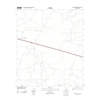
2012 Map of Crockett Heights
USGS Topo · Published 2012About this map
Crockett Heights sits at the northern edge of a vast, high-desert landscape in West Texas where isolated cattle ranches and remote airstrips define the local geography. The area is dominated by an expansive road network that connects several sprawling properties, including the Wilkins Ranch and Clayton Ranch. The presence of the Perry Ranch Airport at the southern boundary suggests the vital role of private aviation in navigating this sparsely populated region of Crockett County. Interstate traffic cuts a straight line through the center of the map along Frontage Rd, contrasting with the secondary routes like Taylor Box Rd and Ranch Road 1312 that service the surrounding family-held lands such as the Davidson Ranch. This 2012 survey illustrates the enduring ranching economy and the modern transit corridors that bridge the wide distances between settlements.
Find a feature on this map
12 named features on this map. Tap any name to fly to it.
Don’t see what you’re looking for? This feature index may not catch every label — zoom into the map to look around manually.
Map Details
Editions of this 2012 Crockett Heights Map
This is the sole edition of this map. No revisions or reprints were ever made.
Other maps of this area

1954 · Sonora
USGS Topo · 1:250,000

1958 · Sonora
USGS Topo · 1:250,000

1964 · Bailey Draw
USGS Topo · 1:24,000

1967 · Nolen Draw
USGS Topo · 1:24,000

1967 · Ozona
USGS Topo · 1:24,000

1967 · Baggett Ranch
USGS Topo · 1:24,000

1967 · Double Mill Draw SE
USGS Topo · 1:24,000

1967 · Ozona SE
USGS Topo · 1:24,000

1967 · Indio Hill
USGS Topo · 1:24,000

1967 · Crockett Heights
USGS Topo · 1:24,000