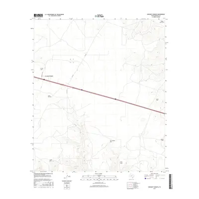
2016 Map of Crockett Heights
USGS Topo · Published 2016About this map
Crockett Heights sits at the intersection of local routes like Crockett Hts Dr and Taylor Rd, serving as a central point in this part of Crockett County. The landscape is defined by an intricate network of seasonal drainage features, including the prominent Turkey Roost Draw to the northeast and Taylor Box Draw near the center. These ephemeral watercourses suggest a terrain shaped by occasional heavy rains in an otherwise arid region. To the south, the Perry Ranch Airport highlights the importance of private aviation for transportation and ranching operations in West Texas. Other landmarks such as Son Chapman Draw and Tucker Draw provide specific points of reference for local land use and geographic orientation.
Find a feature on this map
14 named features on this map. Tap any name to fly to it.
Don’t see what you’re looking for? This feature index may not catch every label — zoom into the map to look around manually.
Map Details
Editions of this 2016 Crockett Heights Map
This is the sole edition of this map. No revisions or reprints were ever made.
Other maps of this area

1954 · Sonora
USGS Topo · 1:250,000

1958 · Sonora
USGS Topo · 1:250,000

1964 · Bailey Draw
USGS Topo · 1:24,000

1967 · Nolen Draw
USGS Topo · 1:24,000

1967 · Ozona
USGS Topo · 1:24,000

1967 · Baggett Ranch
USGS Topo · 1:24,000

1967 · Double Mill Draw SE
USGS Topo · 1:24,000

1967 · Ozona SE
USGS Topo · 1:24,000

1967 · Indio Hill
USGS Topo · 1:24,000

1967 · Crockett Heights
USGS Topo · 1:24,000