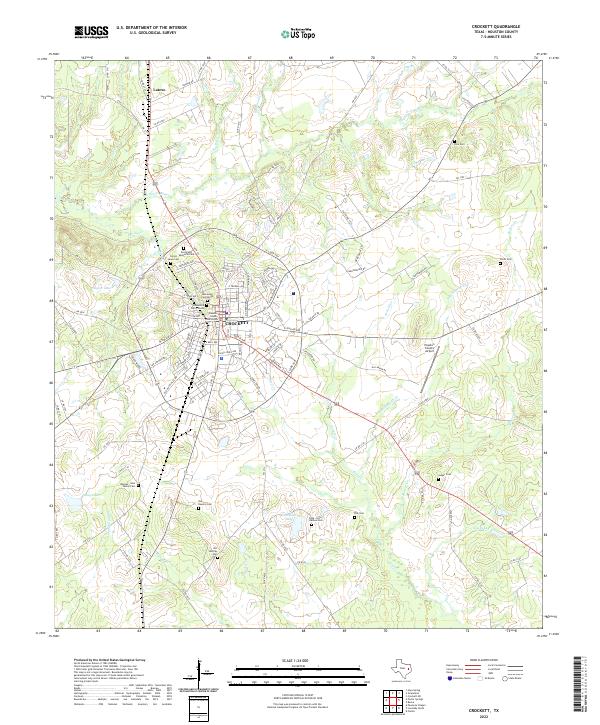
2022 Map of Crockett
USGS Topo · Published 2022About this map
The Houston County Courthouse serves as the central anchor for Crockett, where a radial street pattern extends outward into the surrounding Piney Woods of East Texas. This 2022 survey captures a landscape deeply rooted in family heritage, as evidenced by the dense concentration of small, named burial grounds such as the Rhodes - Neal Family Cem, the Cook - Hale - Barbee Cem, and the Jiel Huntley Cem south of the city. North of the main settlement, the community of Latexo sits along the rail corridor, separated from Crockett by the winding course of Hurricane Bayou. The topography is defined by the complex drainage network of Spring Cr and Dutch Smith Cr, which create the undulating terrain characteristic of Houston County. To the east, the Houston County Airport marks the edge of the modern municipal footprint, while nearby Smith Cem and Rice Cem provide further touchpoints for genealogical research.
Find a feature on this map
114 named features on this map. Tap any name to fly to it.
Don’t see what you’re looking for? This feature index may not catch every label — zoom into the map to look around manually.
Map Details
Editions of this 2022 Crockett Map
This is the sole edition of this map. No revisions or reprints were ever made.
Other maps of this area

1950 · Crockett
USGS Topo · 1:24,000

1950 · Crockett NE
USGS Topo · 1:24,000

1951 · Crockett
USGS Topo · 1:24,000

1951 · Grapeland
USGS Topo · 1:24,000

1951 · Berea
USGS Topo · 1:24,000

1951 · Crockett NE
USGS Topo · 1:24,000

1953 · Palestine
USGS Topo · 1:250,000

1957 · Palestine
USGS Topo · 1:250,000

1963 · Lovelady North
USGS Topo · 1:24,000
1963 · Fodice
USGS Topo · 1:24,000