
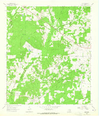
1951 Map of Crockett
USGS Topo · Published 1951About this map
Crockett serves as the focal point of this East Texas survey, where the historic Old San Antonio Trail intersects with the Missouri Pacific railroad. The town's mid-century landscape is defined by institutions like Mary Allen College and local landmarks such as Radio Station Kivy and the Davy Crockett Memorial Park. Outside the town center, the terrain is carved by numerous waterways including Hurricane Bayou and Sookie Creek, while the rural surroundings are dotted with family-named landmarks and community centers. Researchers can find several remote burial grounds like Hopley Cem and Box Cem, alongside local gathering places like Rice Chapel and the Pearson Chapel Sch. A notable nod to the region's pioneer history is preserved in the Old Stagecoach Inn, located northeast of the main settlement near Gia Creek.
Find a feature on this map
30 named features on this map. Tap any name to fly to it.
Don’t see what you’re looking for? This feature index may not catch every label — zoom into the map to look around manually.
Map Details
Editions of this 1951 Crockett Map
This is the sole edition of this map. No revisions or reprints were ever made.
Other maps of this area

1950 · Crockett
USGS Topo · 1:24,000

1950 · Crockett NE
USGS Topo · 1:24,000

1951 · Grapeland
USGS Topo · 1:24,000

1951 · Berea
USGS Topo · 1:24,000

1951 · Crockett NE
USGS Topo · 1:24,000

1953 · Palestine
USGS Topo · 1:250,000

1957 · Palestine
USGS Topo · 1:250,000

1963 · Lovelady North
USGS Topo · 1:24,000
1963 · Fodice
USGS Topo · 1:24,000

1964 · Porter Springs
USGS Topo · 1:24,000