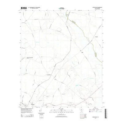
2014 Map of Crocketville
USGS Topo · Published 2014About this map
Crocketville and the surrounding coastal plain of Hampton County appear here as a landscape defined by expansive wetlands and a traditional rural road network. The Salkehatchie River forms a significant natural boundary to the northeast, crossed by the Broxton Bridge. This river system is fed by numerous watercourses, including Sandy Run, Hog Br, and the extensive Whippy Swamp. To the south, the northern portion of Hampton is visible, centered near the intersection of Railroad St and Hoover St. The settlement pattern is largely agricultural, with family-named routes such as Platts Williams Farm Rd and Joe Miley Rd connecting crossroads like Cleland Crossroads and Miley. Genealogists may find interest in the Gooding Cem, located near the center of the survey, and Maulding Millpond, which reflects earlier water-powered industry in the region.
Find a feature on this map
68 named features on this map. Tap any name to fly to it.
Don’t see what you’re looking for? This feature index may not catch every label — zoom into the map to look around manually.
Map Details
Editions of this 2014 Crocketville Map
This is the sole edition of this map. No revisions or reprints were ever made.
Other maps of this area

1918 · Varnville
USGS Topo · 1:62,500

1919 · Olar
USGS Topo · 1:62,500

1919 · Cummings
USGS Topo · 1:62,500

1919 · Lodge
USGS Topo · 1:62,500

1920 · Lodge
USGS Topo · 1:48,000

1921 · Lodge
USGS Topo · 1:62,500

1943 · Olar
USGS Topo · 1:62,500

1943 · Lodge
USGS Topo · 1:62,500

1943 · Orangeburg
USGS Topo · 1:125,000

1943 · Cummings
USGS Topo · 1:62,500