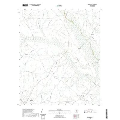
2020 Map of Crocketville
USGS Topo · Published 2020About this map
The Salkehatchie River defines the northeastern boundary of this landscape, winding through a complex of wetlands including Whippy Swamp and Moselle Swamp. These low-lying areas dominate the eastern half of the terrain, contrasting with the inland settlements of Crocketville and Cleland Crossroads. The network of local routes, such as the Old Salkehatchie Hwy and Mozelle Hwy, connects the rural hamlets of Miley and Moselle to the larger northern edge of Hampton in the south.
Find a feature on this map
71 named features on this map. Tap any name to fly to it.
Don’t see what you’re looking for? This feature index may not catch every label — zoom into the map to look around manually.
Map Details
Editions of this 2020 Crocketville Map
This is the sole edition of this map. No revisions or reprints were ever made.
Other maps of this area

1918 · Varnville
USGS Topo · 1:62,500

1919 · Olar
USGS Topo · 1:62,500

1919 · Cummings
USGS Topo · 1:62,500

1919 · Lodge
USGS Topo · 1:62,500

1920 · Lodge
USGS Topo · 1:48,000

1921 · Lodge
USGS Topo · 1:62,500

1943 · Olar
USGS Topo · 1:62,500

1943 · Lodge
USGS Topo · 1:62,500

1943 · Orangeburg
USGS Topo · 1:125,000

1943 · Cummings
USGS Topo · 1:62,500