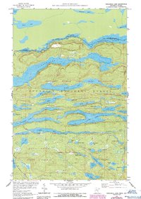
1959 Map of Crocodile Lake
USGS Topo · Published 1986About this map
The Canada-United States border cuts through the northern waters of this wilderness region, following a chain of lakes and historic travel routes. The landscape is defined by the Boundary Waters Canoe Area Wilderness and the Superior National Forest, where a dense network of water bodies like Clearwater Lake and Mountain Lake are connected by traditional paths such as the Watap Portage. To the south, the Pat Bayle State Forest encompasses the drainage of the Crocodile River, which flows out of Crocodile Lake. The southwestern corner is anchored by the historic Gunflint Trail, providing the primary terrestrial access into this watery expanse. This survey, photorevised in the 1980s from late-1950s data, records the intricate bathymetry and topography of a region where the international boundary was defined by the very waterways used for centuries by indigenous people and early traders.
Find a feature on this map
53 named features on this map. Tap any name to fly to it.
Don’t see what you’re looking for? This feature index may not catch every label — zoom into the map to look around manually.
Map Details
Editions of this 1959 Crocodile Lake Map
3 editions found
Other maps of this area

1954 · Two Harbors
USGS Topo · 1:250,000

1957 · Two Harbors
USGS Topo · 1:250,000

1957 · Quetico
USGS Topo · 1:250,000

1958 · Two Harbors
USGS Topo · 1:250,000

1959 · Northern Light Lake
USGS Topo · 1:24,000

1959 · Pine Mountain
USGS Topo · 1:24,000

1959 · Lima Mountain
USGS Topo · 1:24,000

1959 · Hungry Jack Lake
USGS Topo · 1:24,000

1959 · Pine Lake West
USGS Topo · 1:24,000

1959 · Crocodile Lake
USGS Topo · 1:24,000