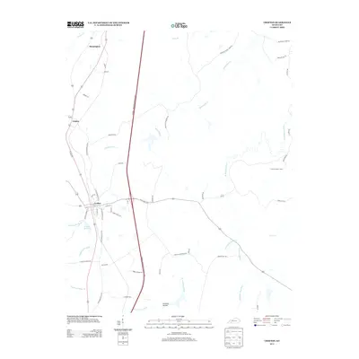
2013 Map of Crofton
USGS Topo · Published 2013About this map
Crofton and the small settlements of Empire and Mannington anchor this western Kentucky landscape, where the headwaters of the Pond River system converge. The terrain is defined by the winding paths of the W Fork Pond River, E Br Pond River, and Middle Br Pond River, which drain the lowlands south of the Crofton Reservoir. The transport network here is a mix of high-speed corridors and older family-named routes, with the Edward T. Breathitt Pennyrile Parkway bisecting the quadrangle while rural ways like Johnson Mill Rd and Atkinson School House Rd preserve the memory of earlier community hubs.
Find a feature on this map
53 named features on this map. Tap any name to fly to it.
Don’t see what you’re looking for? This feature index may not catch every label — zoom into the map to look around manually.
Map Details
Editions of this 2013 Crofton Map
This is the sole edition of this map. No revisions or reprints were ever made.
Other maps of this area

1909 · Dawson Springs
USGS Topo · 1:48,000

1911 · Dawson Springs
USGS Topo · 1:62,500

1912 · Nortonville
USGS Topo · 1:62,500

1952 · Pleasant Green Hill
USGS Topo · 1:24,000

1952 · Kelly
USGS Topo · 1:24,000

1952 · Honey Grove
USGS Topo · 1:24,000

1952 · Crofton
USGS Topo · 1:24,000

1953 · Dawson Springs SE
USGS Topo · 1:24,000

1953 · Haleys Mill
USGS Topo · 1:24,000

1953 · Nortonville
USGS Topo · 1:24,000