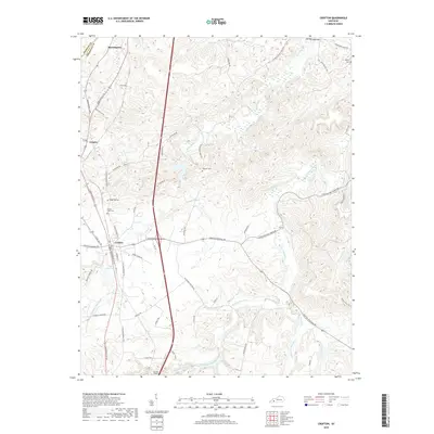
2019 Map of Crofton
USGS Topo · Published 2019About this map
The town of Crofton serves as the central hub of this modern Kentucky survey, where the convergence of N Madisonville St, E Princeton St, and several other local arteries meet. The landscape is deeply carved by the West Fork Pond River and its various tributaries, including the Middle Br Pond River and Coal Creek. To the north, the small settlements of Mannington and Empire sit near the border with Hopkins County, connected by the long-established Madisonville Rd. For local history researchers, several burial grounds are precisely located across the terrain, notably Flatrock Cem, Ridge Top Cem, and Wynns Cem in the northeast. The geography transitions from the concentrated residential blocks of Crofton to the more isolated agricultural and wooded sections like Gumlick Hollow and the elevations around Red Hill.
Find a feature on this map
61 named features on this map. Tap any name to fly to it.
Don’t see what you’re looking for? This feature index may not catch every label — zoom into the map to look around manually.
Map Details
Editions of this 2019 Crofton Map
This is the sole edition of this map. No revisions or reprints were ever made.
Other maps of this area

1909 · Dawson Springs
USGS Topo · 1:48,000

1911 · Dawson Springs
USGS Topo · 1:62,500

1912 · Nortonville
USGS Topo · 1:62,500

1952 · Pleasant Green Hill
USGS Topo · 1:24,000

1952 · Kelly
USGS Topo · 1:24,000

1952 · Honey Grove
USGS Topo · 1:24,000

1952 · Crofton
USGS Topo · 1:24,000

1953 · Dawson Springs SE
USGS Topo · 1:24,000

1953 · Haleys Mill
USGS Topo · 1:24,000

1953 · Nortonville
USGS Topo · 1:24,000