
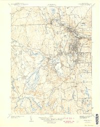
1943 Map of Crompton
USGS Topo · Published 1943About this map
The South Branch Pawtuxet River and its industrial tributaries anchor this wartime portrait of central Rhode Island. The landscape is defined by the heavy concentration of textile-era villages such as Phenix, Arctic, Crompton, and Quidnick, which are densely clustered along the river's winding course. These settlements are interconnected by the New York New Haven and Hartford Railroad, illustrating the 1940s dependence on rail for both transit and trade.
Find a feature on this map
80 named features on this map. Tap any name to fly to it.
Don’t see what you’re looking for? This feature index may not catch every label — zoom into the map to look around manually.
Map Details
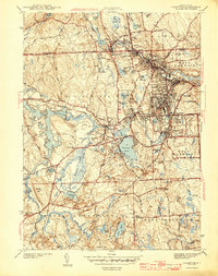
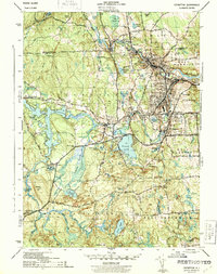
Editions of this 1943 Crompton Map
4 editions found
Other maps of this area

1887 · Providence
USGS Topo · 1:62,500

1889 · Providence
USGS Topo · 1:62,500

1889 · Burrillville
USGS Topo · 1:62,500

1890 · Narragansett Bay
USGS Topo · 1:62,500

1890 · Kent
USGS Topo · 1:62,500

1892 · Narragansett Bay
USGS Topo · 1:62,500

1894 · Burrillville
USGS Topo · 1:62,500

1894 · Kent
USGS Topo · 1:62,500

1894 · Providence
USGS Topo · 1:62,500

1915 · Burrillville
USGS Topo · 1:62,500