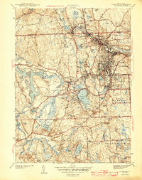
1943 Map of Crompton
USGS Topo · Published 1943About this map
The South Branch Pawtuxet River and its various tributaries drive the industrial and residential settlement patterns of Kent County during the early 1940s. Densely populated textile and manufacturing villages such as Arctic, Crompton, and Quidnick line the river banks, reflecting a landscape defined by 19th-century water power and rail access. The New York New Haven and Hartford railroad cuts through these river valleys, connecting the mill towns of Anthony and Washington to the broader regional economy.
Find a feature on this map
82 named features on this map. Tap any name to fly to it.
Don’t see what you’re looking for? This feature index may not catch every label — zoom into the map to look around manually.
Map Details
Editions of this 1943 Crompton Map
4 editions found
Other maps of this area

1887 · Providence
USGS Topo · 1:62,500

1889 · Providence
USGS Topo · 1:62,500

1889 · Burrillville
USGS Topo · 1:62,500

1890 · Narragansett Bay
USGS Topo · 1:62,500

1890 · Kent
USGS Topo · 1:62,500

1892 · Narragansett Bay
USGS Topo · 1:62,500

1894 · Burrillville
USGS Topo · 1:62,500

1894 · Kent
USGS Topo · 1:62,500

1894 · Providence
USGS Topo · 1:62,500

1915 · Burrillville
USGS Topo · 1:62,500