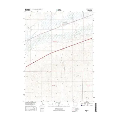
2016 Map of Crook
USGS Topo · Published 2016About this map
The South Platte River winds through the northern half of this Logan County landscape, serving as the central artery for a complex system of agricultural irrigation. The town of Crook is the primary settlement, positioned near the riverbank where local streets like 2nd Ave and 4th Ave meet the regional transport corridor of Co RD 138. This irrigation network is highly detailed, featuring Harmony Ditch Number 1, Harmony Ditch Number 2, and Harmony Ditch Number 3, alongside Chambers Ditch, illustrating the intensive management of water in the high plains. Further west, the settlement of Tobin sits near the river, while the surrounding territory includes the Tamarack Ranch and Uhler Ranch. The terrain south of the river rises away from the floodplain, marked by Spring Canyon and the isolated Coyote Spring, showing the contrast between the lush river valley and the arid uplands.
Find a feature on this map
31 named features on this map. Tap any name to fly to it.
Don’t see what you’re looking for? This feature index may not catch every label — zoom into the map to look around manually.
Map Details
Editions of this 2016 Crook Map
This is the sole edition of this map. No revisions or reprints were ever made.
Other maps of this area

1953 · Tamarack Ranch
USGS Topo · 1:24,000

1953 · Crook
USGS Topo · 1:24,000

1953 · Twin Buttes
USGS Topo · 1:24,000

1953 · Proctor
USGS Topo · 1:24,000

1953 · Haystack Butte
USGS Topo · 1:24,000

1953 · Julesburg Reservoir
USGS Topo · 1:24,000

1954 · Sterling
USGS Topo · 1:250,000

1958 · Sterling
USGS Topo · 1:250,000

1962 · Fleming
USGS Topo · 1:24,000

1962 · Uhler Ranch
USGS Topo · 1:24,000