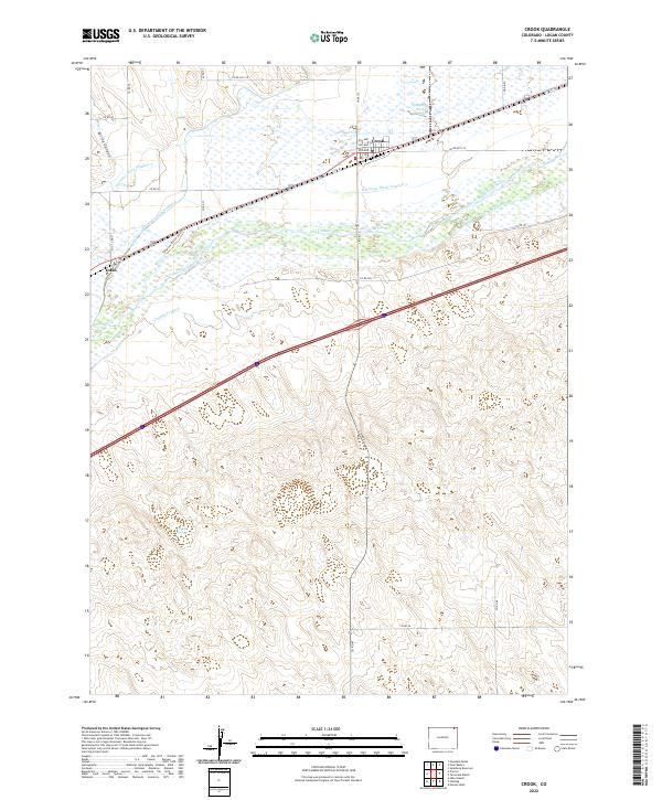
2022 Map of Crook
USGS Topo · Published 2022About this map
The South Platte River winds through the northern portion of this Logan County landscape, sustaining a complex network of irrigation infrastructure essential to the high plains. The settlement of Crook is the primary hub, where numbered streets like 2nd Ave and 3rd Ave meet C R 138. Further west along the river lies Tobin, a secondary rail-aligned point of interest.
Find a feature on this map
32 named features on this map. Tap any name to fly to it.
Don’t see what you’re looking for? This feature index may not catch every label — zoom into the map to look around manually.
Map Details
Editions of this 2022 Crook Map
This is the sole edition of this map. No revisions or reprints were ever made.
Other maps of this area

1953 · Tamarack Ranch
USGS Topo · 1:24,000

1953 · Crook
USGS Topo · 1:24,000

1953 · Twin Buttes
USGS Topo · 1:24,000

1953 · Proctor
USGS Topo · 1:24,000

1953 · Haystack Butte
USGS Topo · 1:24,000

1953 · Julesburg Reservoir
USGS Topo · 1:24,000

1954 · Sterling
USGS Topo · 1:250,000

1958 · Sterling
USGS Topo · 1:250,000

1962 · Fleming
USGS Topo · 1:24,000

1962 · Uhler Ranch
USGS Topo · 1:24,000