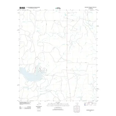
2012 Map of Crooked Creek
USGS Topo · Published 2012About this map
Lake Coleman dominates the southwestern quadrant of this 2012 survey, revealing the modern shoreline and residential development in Callahan County. Street names like Lakeview Dr, Scenic Dr, and Quail Creek Dr indicate the recreational and residential growth around the lake, supported by FM-1274. This modern landscape is defined by its water management infrastructure, featuring the Soil Conservation Service Site 22 Reservoir and Soil Conservation Service Site 8 Reservoir which capture local drainage.
Find a feature on this map
22 named features on this map. Tap any name to fly to it.
Don’t see what you’re looking for? This feature index may not catch every label — zoom into the map to look around manually.
Map Details
Editions of this 2012 Crooked Creek Map
This is the sole edition of this map. No revisions or reprints were ever made.
Other maps of this area

1887 · Coleman
USGS Topo · 1:125,000

1889 · Coleman
USGS Topo · 1:125,000

1890 · Abilene
USGS Topo · 1:125,000

1892 · Abilene
USGS Topo · 1:125,000

1892 · Ballinger
USGS Topo · 1:125,000

1931 · Baird
USGS Topo · 1:125,000

1932 · Baird
USGS Topo · 1:125,000

1954 · Brownwood
USGS Topo · 1:250,000

1954 · Abilene
USGS Topo · 1:250,000

1958 · Abilene
USGS Topo · 1:250,000