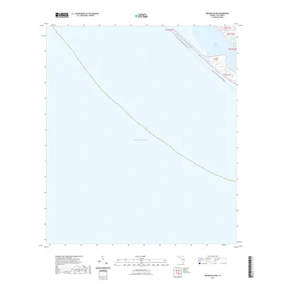
2021 Map of Crooked Island
USGS Topo · Published 2021About this map
Crooked Island forms a protective barrier along this stretch of the Florida Panhandle, separating the open waters of the Gulf of Mexico from the more sheltered interior basins. The map illustrates a coastal landscape defined by shifting sands and saltwater inlets, most notably the waters of Saint Andrew Sound and the secluded Wild Goose Lagoon. These features are connected by the Florida Circumnavigational Paddling Trl, which tracks the interior shoreline of the barrier system. The absence of traditional roads or settlements emphasizes the maritime and ecological character of this reach of Bay County, where the topography is shaped by the tides rather than human industry. This survey serves as a record of the shoreline's configuration in the early 21st century, showing how the sound and its lagoons interface with the Gulf.
Find a feature on this map
7 named features on this map. Tap any name to fly to it.
Don’t see what you’re looking for? This feature index may not catch every label — zoom into the map to look around manually.
Map Details
Editions of this 2021 Crooked Island Map
This is the sole edition of this map. No revisions or reprints were ever made.
Other maps of this area

1943 · Beacon Beach
USGS Topo · 1:31,680

1943 · Crooked Island
USGS Topo · 1:31,680

1944 · Beacon Hill
USGS Topo · 1:31,680

1944 · Long Point
USGS Topo · 1:31,680

1945 · Allanton
USGS Topo · 1:31,680

1945 · St Joseph Point
USGS Topo · 1:31,680

1947 · Allanton
USGS Topo · 1:25,000

1949 · Apalachicola
USGS Topo · 1:250,000

1954 · Tallahassee
USGS Topo · 1:250,000
1956 · Beacon Hill
USGS Topo · 1:24,000